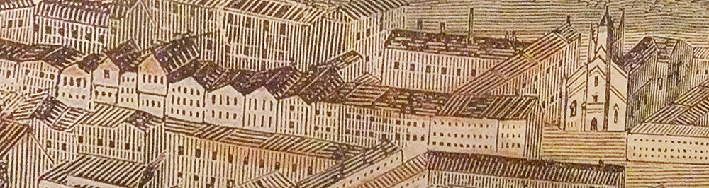
This wood engraving, depicting Bermondsey Street in 1845, is the earliest illustrative image I have seen showing the street in its full length. It is a close-up from ‘Panorama of London‘ by Frederick James Smyth, which I first came across on a visit to the Maritime Museum in Greenwich in 2014. His work was originally issued as a 12-page supplement in the Illustrated London News. The full-sized illustration (shown below) captures Vauxhall in the west, through central London, and across to Greenwich in the east, and is over 7½ feet wide (2370mm).
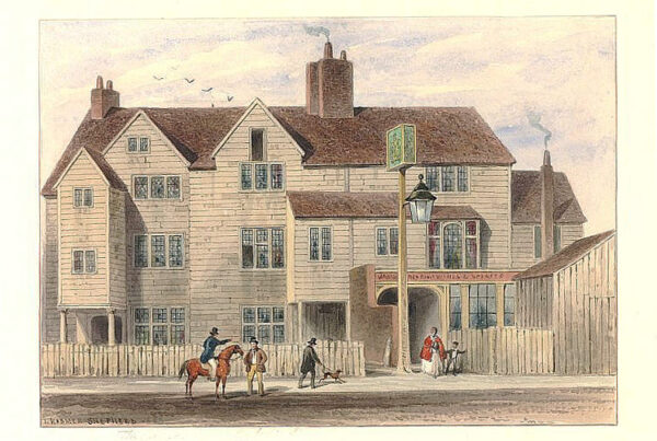
The only truly recognisable building in Bermondsey Street to the modern eye is the church of St Mary Magdalen, which underwent an extensive Gothic makeover under the guidance of George Porter in 1830. In Smyth’s illustration, the church appears set back from the road, which was certainly not the case in an earlier illustration of the church (rebuilt in 1676), which shows a portico stretching over the pavement and fronting the road. Given that Smyth was working on such an extensive brief, my view is that this was either an error or that he applied a little artistic license, which went uncorrected.
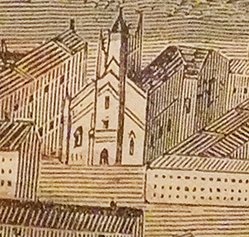
A close-up of Greenwood’s 1827 Map of London reveals that Bermondsey Street did jut out near the junction with Abbey Street, where the Watch House Cafe is today. The Old Rectory isn’t shown in Smyth’s picture, but we should consider that he won’t have included every building. It’s also possible that the Rectory is not as old as it looks. This is undoubtedly the case with the Time and Talents building next door, which was built in 1899.
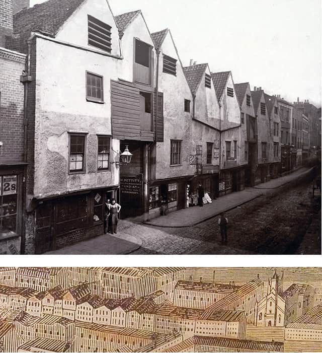 Smyth’s illustration proves helpful in locating the row of shops photographed by Alfred Henry Bool in 1880. Buildings matching the roof line of those in Bool’s view of Bermondsey Street are visible, and these confirm the position I had identified in my earlier research.
The opening of Tower Bridge Road in 1902 may possibly have saved Bermondsey Street from town planners and from wholesale redevelopment during the 20th century, had it stayed as a main route to the [Old] Kent Road. The street’s character remained largely intact, and the creation of the conservation area in 1973 formally recognised its importance. The mural, which adorned the side of 4 Tanner Street, celebrated many of the locals who were active during that time.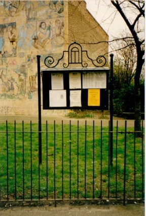
Bermondsey Street has evolved and changed several times over the centuries, with the coming and going of different industries. The extensive leather works, tanneries, and associated industries are long gone, and the antiques trade, which arrived and settled following the relocation of the New Caledonian Market in 1949, has largely moved on.
 By the turn of 1990, the retail and food presence was only at Rose’s Cafe, the newsagent, the Post Office, George the barber, the Marigold, the Woolpack, and the Yorkshire Grey. You could often walk from one end of Bermondsey Street to the other without passing a single person. Redevelopment was inevitable, and it was just a question of …when?
The formation of the Bermondsey Street Association (now BermondseyStreet.London) and Leathermarket JMB in the 1990s saw both organisations take instrumental roles in supporting the local area, with additional support coming from Bermondsey Village Hall. Improvements to local estates, the building of a new playground, and a partnership with the Civic Trust are testament to this.
The pace of change in SE1 generally over the past 10 to 15 years has been quite staggering. Some developments in Bermondsey Street, such as the Fashion and Textile Museum, have had a real effect in helping to revitalise the area, and the growth of small, independent shops, restaurants and businesses has also added to the area, where before, there was nothing.
The Shard, beautiful as it is, offers nothing at street level, yet has changed everything for London Bridge and the surrounding area. The character of Bermondsey Street lying in its shadow is under threat like never before, and some shops and restaurants have recently succumbed to steep rent rises. This trend is likely to accelerate, especially once the redevelopment of London Bridge Station is complete.
Property developers and estate agents have been marketing SE1 directly to investors in the Far East for some time, and this wealth outside of the UK will continue to drive change across the area south of the river. New ‘affordable housing to rent’ is scarce, and ‘affordable housing to buy’ is a near impossibility for most, given the rise in land values across London. Many who have lived in Bermondsey for generations have understandably felt pushed out, where a better solution would have been to make room for everybody.
Alfred Bool took his Victorian photos of Bermondsey at a time when the street was under threat of redevelopment, and Frederick James Smyth’s 1845 woodcut serves as a reminder that redevelopment is a cycle that has all happened before. I wonder if, in 100 years’ time, St Mary Magdalen will be the only recognisable building still standing? Maybe by then it will be due a makeover, and if this happens, this too won’t be the first time.
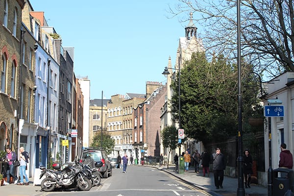
The closest I could get to creating a panorama of Bermondsey Street was from the top of Simla House in Weston Street. St Mary Magdalen is still visible if you look closely. Click this link or the letterbox image below to see a much larger image.